About Bare Island East
Sheltered eastern shore dive of heritage-listed Bare Island with sponge gardens, rocky walls, swim‑throughs, and abundant macro and megafauna.
Bare Island East Weather Forecast
About this forecast
7-day weather forecast for Sydney, NSW sourced from Open-Meteo. Daily high/low temperatures, conditions and rain probability.
Bare Island East Swell Forecast
About this forecast
Site-specific wave heights adjusted for Bare Island East's exposure, orientation and depth profile. Colour bands: green = ideal, orange = marginal, red = undiveable.
Bare Island East Tide Chart
About this chart
Today's tide chart with best on incoming tide or slack high tide conditions highlighted in green. This site dives best best on incoming tide or slack high tide. Upgrade to Essential or Pro to unlock the 5-day tide chart.
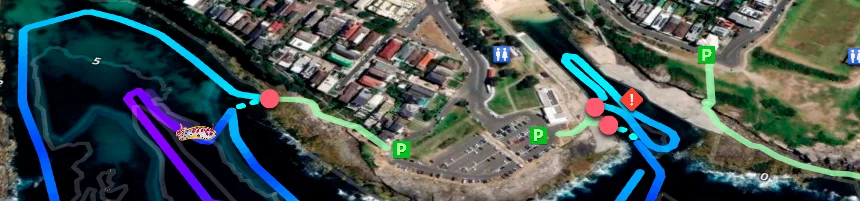
Bare Island East is the most accessible of the three dives around heritage-listed Bare Island at La Perouse, sitting on the sheltered eastern shore where swell rarely builds and the rock entry is straightforward for most experience levels. The terrain runs to 12 m along a reef wall draped in sponge gardens, with swim-throughs cutting through the boulder sections and sandy patches providing contrast between the reef zones. It is a reliable macro site where nudibranchs, seahorses, and octopus are regular finds, and the heritage island setting above water — connected to the mainland by a timber pedestrian bridge — adds genuine historical character to the location that few Sydney dive sites can match.
Visibility averages around 8 m. Allow at least a week after rain before visiting — runoff sensitivity is high and water quality takes time to recover after significant rainfall. The sheltered eastern aspect protects the site from northerly through to easterly swells, making it a practical fallback option when the exposed south-east-facing sites in the area are out of condition. Best dived on an incoming tide or around high slack. Kayak and boat traffic operate in the area throughout the day; deploy a DSMB before surfacing and take care at the rocky entry and exit, which can carry weed and become slippery even in otherwise calm conditions.
The south-east swell direction is the one to watch specifically at this site. When a genuine south-easterly groundswell is running, the eastern shore can become significantly more exposed than its usual sheltered character suggests. Always check both swell height and direction before heading out — height alone does not tell the full story here.
Restrooms and picnic areas are available near the island bridge. The east side of Bare Island is also the recommended starting point for divers new to the area, both because the entry is simpler than the west and deep wall sides and because the species inventory here represents a good cross-section of what Bare Island delivers across all three sites. Mapping the east side thoroughly on a first visit gives divers a useful reference for understanding how the habitat changes as you move around the island to the more demanding western sites. The combination of cave sections, sponge gardens, and kelp on the east face provides enough terrain variety to occupy a full dive without needing to push depth or distance.
The heritage island is worth exploring before or after the dive — the old fort buildings and views back toward the city make for a genuinely complete outing. Restrooms and picnic areas are near the island bridge. Abyss Scuba Diving is 15.8 km (20 min).