📍 Sydney, NSW

Malabar Wreck & Reef

Beginner
Live
Status
Visibility
Score
Wave
Wind

About Malabar Wreck & Reef

Explore the scattered remains of the MV Malabar—a 1925 passenger-cargo ship that ran aground in heavy fog in 1931. This scenic DPV route winds along the coastline from Malabar Beach, passing the ship’s engine block and flywheel before reaching deeper waters around Long Bay's dramatic northern headland.

Live Conditions
Score
Visibility
Predicted
Depth
8m
Experience
Beginner
Best Vis
10m
Rating
starstarstarstar

Malabar Wreck & Reef 7-Day Weather Forecast

About this forecast

7-day weather forecast for Sydney, NSW sourced from Open-Meteo. Shows daily high/low temperatures, weather conditions and rain probability — useful for planning your drive to Malabar Wreck & Reef.

Wave Height
Offshore
Wind
Knots

Malabar Wreck & Reef 7-Day Swell & Wave Height Forecast

Malabar Wreck & Reef site-specific wave heights calculated by Pelagic Hadal Conditions Intelligence™
About this forecast

7-day swell forecast for Malabar Wreck & Reef, calculated using Pelagic's Hadal Conditions Intelligence™. Wave heights are site-specific — adjusted for Malabar Wreck & Reef's exposure, orientation and depth profile. Colour bands show diveable conditions at this site: green is ideal, orange is marginal, red is undiveable.

Optimal Dive Times & Tide Chart — Malabar Wreck & Reef

Tide times and optimal dive windows for Malabar Wreck & Reef, Sydney, NSW
About this chart

5-day tide chart for Malabar Wreck & Reef showing high and low tides with incoming to high tide conditions highlighted as green. Tidal movement directly affects visibility and current strength at Malabar Wreck & Reef — plan your entry to coincide with the green windows for the best conditions.

Tide data is site-specific and accounts for Malabar Wreck & Reef's tidal sensitivity. This site dives best incoming to high tide.

Malabar Wreck & Reef Location

Open full map in Pelagic
Pelagic

There's a lot more to Malabar Wreck & Reef

Smart trails, marine life hotspots, NaviCodes™ and reef maps.

🌊 Unlock Pelagic Pro
Smart Dive Trails
Smart Dive Trails™
Guided underwater routes to the best reefs and walls.
Marine Life Hotspots
Pinpointed locations for turtles, sharks and rays.
NaviCodes™
NaviCodes™
Bearings for your slate — navigate trails underwater.
Reef & Wall Maps
Reef & Wall Maps
Drop-offs and depth contours overlaid on the map.
Pelagic Smart Dive Trails
Free to explore · Pro from $2.88/week · Ad-free
Trusted by NSW divers See all Pro features →

Dive Site Guide

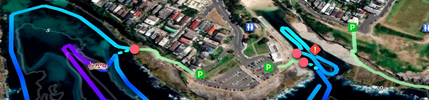
The Malabar Wreck is the scattered remains of the MV Malabar — a 1925 passenger-cargo vessel that ran aground in heavy fog in 1931 on the rocky coastline south of Malabar Beach. What remains is spread across the reef in fragments: the engine block and flywheel are the most substantial and most visited pieces, sitting in 8–23 m of water along a DPV route that winds south from Malabar Beach past the wreck sections and out toward the dramatic northern headland of Long Bay. The combination of heritage wreckage, rocky reef, and the deep terrain around the headland gives this site a range and variety that no single dive can fully cover.

DPV is essentially mandatory for reaching the best sections efficiently. The turnaround point for the wreck itself is around 500 m from the entry — beyond that distance without a scooter, the surface swim back becomes a significant exertion that cuts into bottom time and limits how much of the terrain divers can actually explore. The route beyond 500 m toward the headland is recommended via DPV only and should not be attempted by fin-powered divers without extensive experience and a twinset or stage cylinder. The wreck sections themselves are heritage-protected — do not remove or disturb any artefact.

Visibility averages around 10 m and the site is notably more tolerant than most Sydney shore dives. Tide sensitivity is just 1/5 with all phases listed as optimal, and the wave limit is 1.1 m — substantially higher than the harbour and bay sites. Runoff sensitivity is 2/5, meaning rainfall has minimal impact on water quality. The protection level of 3/5 provides reasonable shelter from direct ocean swell. Heavy surge near the wreck and around the point remains a hazard even in moderate conditions — assess carefully before committing to the outer sections.

Sharp, rusty metal is present throughout the wreck debris field — gloves are advisable. Always carry a float or DSMB given the boat traffic along this stretch of coast. There are no facilities at the site. The wreck also has genuine historical interest worth researching before the dive. The MV Malabar was carrying passengers and cargo when it grounded in fog in 1931, and the circumstances of the grounding — a vessel that knew the coast well, taken by a combination of fog, current, and a navigation error — are a useful reminder of the conditions that claimed ships on this stretch of coastline. The engine block and flywheel are the most intact remaining pieces and are large enough to provide genuine scale and context underwater. Heritage protection applies — no collection or disturbance of artefacts.

Pro Dive Alexandria is the closest shop at 10.2 km (17 min), with Dive Centre Bondi at 10.1 km (18 min).

Site Brief
Best Conditions
Low swell after a period of no rain
Tide
Incoming to high tide
Current
Moderate to heavy surge around wreck and point
Bottom
Rusting wreck fragments, engine block, propeller, rocky reef and sandy patches
Water Temperature
Summer: 21–24 °C Winter: 15–18 °C
Hazards & Warnings
Not recommended beyond the turn around point at 500 m without a DPV unless experienced with 2 km+ range and heavy swell. Access to the wreck and around the point recommended via DPV only. Heavy surge near wreck even in moderate swell—avoid after rainfall. Potential boat traffic (float / DSMB required). Sharp, rusty metal. Heritage‑protected site—do not remove artifacts.
Site Access
Fees
None
Facilities
None
Nearby Services
Nearby Dive Shops
Pro Dive Alexandria (10.2 km / 17 min) 📍 Dive Centre Bondi (10.1 km / 18 min)
Common Questions
How deep is Malabar Wreck & Reef?
Malabar Wreck & Reef reaches a maximum depth of 8m. This makes it suitable for newly certified divers.
Is Malabar Wreck & Reef suitable for beginners?
Yes — Malabar Wreck & Reef is rated beginner-friendly. Newly certified divers and snorkelers will feel comfortable here.
What is the visibility like at Malabar Wreck & Reef?
Pelagic's Azure™ model predicts an expected visibility of around 10m at Malabar Wreck & Reef. Typical visibility is 5 – 10 m. Visibility varies with swell, rainfall and tidal conditions — check the live prediction above before heading out.
When is the best time to dive Malabar Wreck & Reef?
Low swell after a period of no rain. (Incoming to high tide). Use the tide chart and swell forecast above to plan your entry window.
Are there any hazards at Malabar Wreck & Reef?
Not recommended beyond the turn around point at 500 m without a DPV unless experienced with 2 km+ range and heavy swell. Access to the wreck and around the p… See the Hazards section below for full details.
What is the water temperature at Malabar Wreck & Reef?
21–24 °C / 15–18 °C — summer to winter range. A 5mm wetsuit is recommended for winter, while a 3mm or shorty is fine in summer.
🌊 Open on the Pelagic Map
Real-time visibility, diver reports and marine life sightings — all in one place. Free to use.
Open in Pelagic — Free
More Dive Sites in Sydney
📍 Lilly Pilly 📍 Shiprock 📍 Bass and Flinders 📍 Oak Park 📍 Windy Point 📍 Shark Island